Geophysical Center of the Russian Academy of Sciences, Moscow, Russia
World Data Center for Solid Earth Physics
The Geotraverse Project
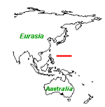
The Philippine Sea Geotraverse

Format Description for the Earthquake Catalogue
  Earthquake Catalogue has been composed from three parts:

   1. (GUTE) Catalog of hypocenters and magnitudes listed in Gutenberg
      and Richter (1954), 1904 - 1952.
      Global Hypocenter Data Base CD-ROM, version 3.0, 1994, NEIC, USGS.

      Gutenberg, B., and  Richter,  C.F.,  1954,  Seismicity of the
      Earth and associated phenomena;  Princeton University Press,
      Princeton,  NJ, 310 p.


   2. (PDE)   Preliminary   Determination  of  Epicenters,  NEIC,  USGS,
      1868-1992. Catalog of earthquakes located by the USGS NEIC and its
      predecessors  in  the U.S.  Coast and Geodetic Survey the National
      Ocean Survey,  and the Environmental Research Laboratories of  the
      Department  of  Commerce.  Listings  are  in  most cases the final
      hypocenters and magnitudes of the USGS NEIC which  are  listed  in
      the  Geological Survey publication,  "Preliminary Determination of
      Epicenters - Monthly Listing".
      Global Hypocenter Data Base CD-ROM, version 3.0, 1994, NEIC, USGS.

   3. (PDE, PDE-W, PDE-Q) USGS/NEIC, 1973-PRESENT:

      Catalog of earthquakes located by the USGS NEIC and its
      predecessors in the U.S. Coast and Geodetic Survey, the National
      Oceanic Survey, and the Environmental Research Laboratories of the
      Department of Commerce. Listings are from three different publications:

      (PDE-W) PDE Weekly Listing. This file covers the time period following
      the Monthly data up to four weeks behind the current week. The Weekly
      PDE data are replaced by the Monthly PDE data as soon as they become
      available.
      USGS/NEIC Most Recent Events (PDE-Q) Daily listing, known as Quick
      Epicenter Determinatins (QED). These data are extremely preliminary
      and the parameters of the earthquakes are subject to change as more
      data are used to relocate the earthquakes. The daily PDE-W covers the
      time fram following the Weekly PDE data up to the current date. These
      data are replaced by the Weekly PDE data.
      (PDE) Preliminary Determinations of Epicenters, Monthly Listing.
      This list is the most complete computation of hypocenters and
      magnitudes done by the USGS NEIC. It is normally produced a few
      months after the events occur. The publication is called "Preliminary"
      because the "final" computation of hypocenters for the world is
      considered to be the Bulletin of the Internation Seismological Centre
      (ISC), which is produced about two years after the earthquakes occur.
      The NEIC PDE program contributes about one-third off all data used by
      the ISC.

      http://wwwneic.cr.usgs.gov/neis/epic/epic.html


 POSITIONS   LENGTH      FORMAT      DESCRIPTION
            OF FIELD

    1- 5        5         (a5)        Catalog Source
    6-11        5         (a6)        Year
   12-13        2         (i2)        Month
   14-15        2         (i2)        Day
   16-24        9         (f9.2)      Origin Time
   17-18        2         (i2)        Minute
   25-26        2         (a2)        Coordinate/OT Authority
   27-33        7         (f7.3)      Latitude in degrees  [- =South]
   34-41        8         (f8.3)      Longitude in degrees [- =West]
   42-46        5         (f5.1)      Depth in kilometers
      47        1         (a1)        Depth Control Designator
   48-49        2         (a2)        pP Phases
   50-53        4         (f4.2)      Standard Deviation
   54-56        3         (f3.1)      mb magnitude
   57-58        2         (i2)        Number of mb amplitudes
   59-61        3         (f3.1)      Ms magnitude
      62        1         (a1)        Z/H Component
   63-64        2         (i2)        Number of Ms amplitudes
   65-68        2         (f4.2)      Contributed Mag1.
   69-70        2         (a2)        Magnitude Scale
   71-75        5         (a5)        Donor
   76-79        4         (f4.2)      Contributed Mag2.
   80-81        2         (a2)        Magnitude Scale
   82-86        5         (a5)        Donor
   87-89        3         (i3)        Flinn-Engdahl Region Number
   90-92        3         (a3)        Station Number/Quality
      93        1         (a1)        Intensity Value
      94        1         (a1)        Cultural Effects
      95        1         (a1)        Isoseismal Map
      96        1         (a1)        Fault Plane Solution flag
      97        1         (a1)        Moment Tensor Flag
      98        1         (a1)        ISC Depth Flag
      99        1         (a1)        IDE flag
     100        1         (a1)        Preferred Hypocenter flag
     101        1         (a1)        Flag
 102-108        7         (a7)        Phenomena Codes
 109-115        8         (a7)        Radial Distance
Seismological Data Sets | Data Sets | Main Page
2001-2016 © WDC for SEP, GC RAS webmaster