|
|
|
|
Earthquakes in the seismically active zones of the Eastern Carpathians and Crimea,
1908−1957
|
The database includes earthquake catalogues compiled by processing data from a network of
stationary seismic stations in the USSR using a unified methodology with an assessment of the reliability of the results,
maps of the location of earthquake epicenters, information about seismic stations, descriptions and bibliography.
The catalogues converted into electronic form (PDF, Excel and ASCII formats) contain standard values of the parameters of each earthquake:
the moment of occurrence, the source position with an assessment of its determination accuracy,
the intensity and magnitude.
The data presented here are a retrospective addition to the earthquake catalogues of
the Carpathian and Crimea seismic regions, starting in 1962 and formed on the basis of data published in the yearbooks
«Earthquakes in the USSR»
and «Earthquakes of Northern Eurasia».
Data source:Atlas of earthquakes in the USSR.
The results of observations of the network of seismic stations of the USSR, 1911-1957.
Eds. E.F. Savarensky, C.L. Solovyov, D.A. Kharin. AS USSR Publishing House, Moscow, 1962.
When creating the earthquake catalogue of the seismically active zone of the Eastern Carpathians
the source material related to the territory of 44−50° N, 19−30° E was used.
Description and bibliography.
Map.
Information about seismic stations.
The main catalogue of the Eastern Carpathian zone
includes data on 39 earthquakes of I−V intensity groups for the period from 1908 to 1957.
The additional catalogue contains
data on 25 earthquakes of I−IV intensity groups for the period from 1903 to 1955,
which were not included in the main catalogue due to the unreliability of their definition.
Catalogues converted into PDF, Excel and ASCII formats.
Format description.
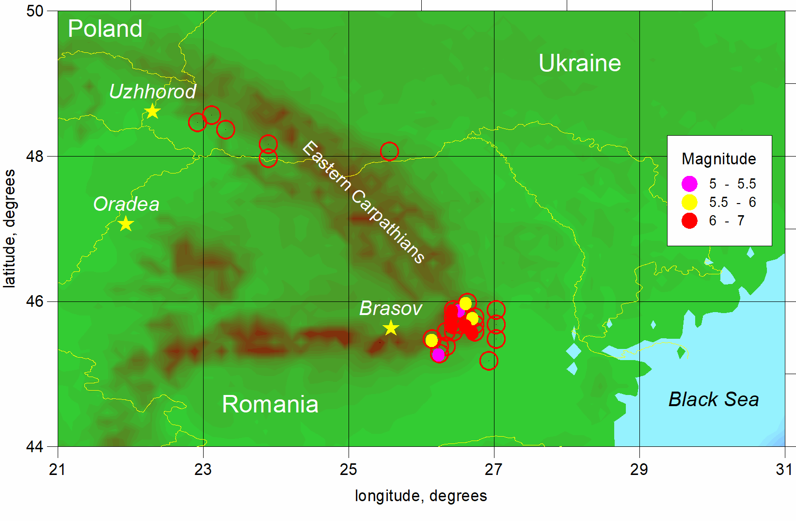
Scheme of the spatial distribution of earthquake epicenters in the Eastern Carpathians.
Red hollow circles indicate earthquakes for which the magnitude is not determined
Source material related to the territory 43.5−46° N, 32−36° E
was used to create a catalogue of earthquakes in the Crimean seismically active zone.
Description and bibliography.
Map.
Information about seismic stations.
The main catalogue of the Crimean seismically active zone
includes data on 131 earthquakes of I−V intensity groups for the period from 1927 to 1957.
The additional catalogue
contains data on 5 events of the IV intensity group for 1927,
which were not included in the main catalogue due to the unreliability of their definition.
Catalogues converted into PDF, Excel and ASCII formats.
Format description.
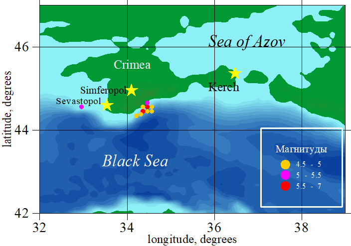
Scheme of the spatial distribution of earthquake epicenters in the Crimea.
Red hollow circles indicate earthquakes for which the magnitude is not determined
|
|
|
|

 Data distributed under license