|
|
|
|
|
Earthquakes in the Caucasian seismically active zone, 1911−1957
|
The database includes earthquake catalogues compiled by processing data from a network of
stationary seismic stations in the USSR using a unified methodology with an assessment of the reliability of the results,
maps of the location of earthquake epicenters, information about seismic stations, description and bibliography.
The catalogues converted into electronic form (PDF, Excel and ASCII formats) contain standard values of the parameters
of each earthquake: the moment of occurrence, the position of source
with an assessment of the accuracy of its determination, the intensity and magnitude.
The data presented here are a retrospective addition to the earthquake catalogue
of the Caucasian seismic region, starting in 1962 and
formed on the basis of data published in the yearbooks «Earthquakes in the USSR»
and «Earthquakes of Northern Eurasia».
Data source: Atlas of earthquakes in the USSR.
The results of observations of the network of seismic stations of the USSR, 1911-1957.
Eds. E.F. Savarensky, C.L. Solovyov, D.A. Kharin. Moscow, 1962.
When creating the earthquake catalogue of the Caucasian seismically active zone
the source material related to the territory of 37.5−46° N, 38−54° E was used.
Description and bibliography.
Maps.
Information about seismic stations.
The main catalogue of the seismically active zone
of the Caucasus includes data on 210 earthquakes of I−IV intensity groups for the period from 1911 to 1957
and non-instrumental data on 5 earthquakes for 1859−1902.
The second part of the main catalogue
includes data on 2518 earthquakes of I−V intensity groups for the period from 1932 to 1957.
The additional catalogue contains
data on 55 events of III−IV intensity groups for the period from 1908 to 1940,
which were not included in the main catalogue due to the unreliability of their definition.
Based on data from expeditionary seismic observations carried out in 1949−1953,
two earthquake catalogues have been compiled:
Catalogue of earthquakes in
the South-East of the Greater Caucasus (Shemakha region),
containing data on 248 events in 1951−1953 on the territory with coordinates 40.3−41.5° N, 47.1−49.9° E.
Catalogue of earthquakes in
the Javakheti (Akhalkalaki) highlands, containing data on 18 events in 1950−1951 on the territory with coordinates
40.7−42.0° N, 42.8−44.5° E.
Catalogues converted into PDF, Excel and ASCII formats.
Format description.
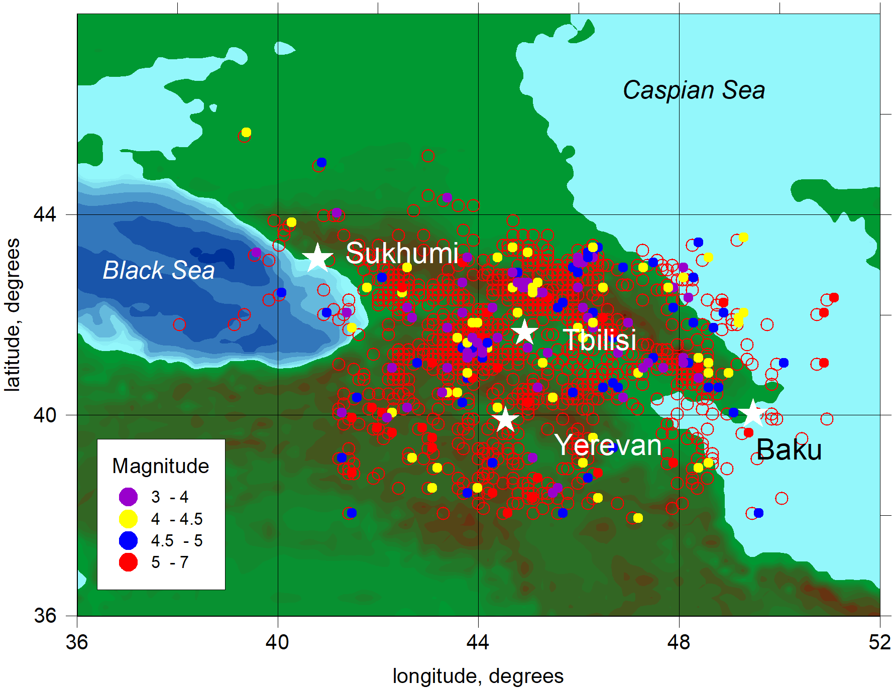
Scheme of the spatial distribution of earthquake epicenters in the Caucasus zone.
Red hollow circles indicate earthquakes for which the magnitude is not determined
|
|
|
|

 Data distributed under license